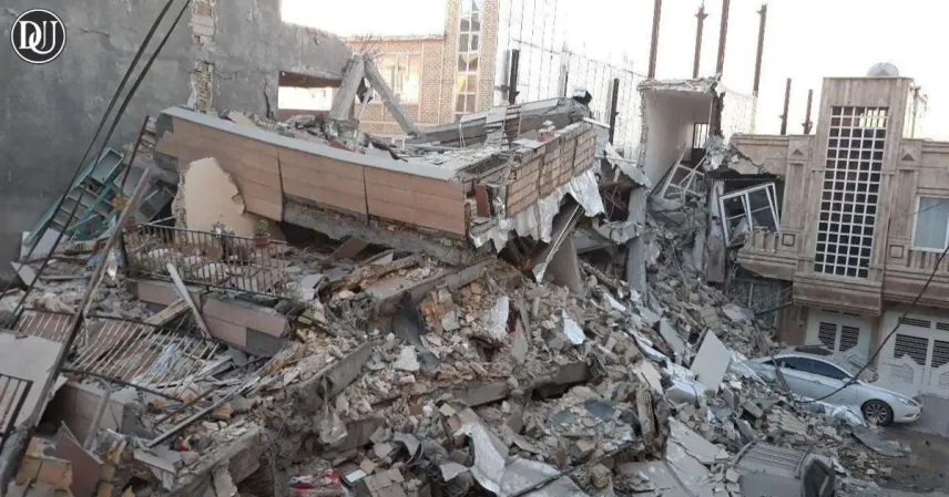
A 5.1 magnitude iran earthquake struck the Semnan province in northern Iran on Friday, sending tremors across several cities and prompting local authorities to issue precautionary alerts. The quake hit at a depth of 7 km, as per initial seismological assessments. Fortunately, no significant casualties or damage have been reported so far, but minor structural cracks have been observed in nearby villages.
Timing and Location
The tremor occurred at approximately 3:30 a.m. local time near the town of Mehdishahr, in Semnan province. Located about 120 km east of Tehran, Semnan is not unaccustomed to seismic activity. However, the timing and geopolitical backdrop have intensified public concern.
The iran earthquake epicenter was relatively shallow, which typically increases the likelihood of surface-level damage. Emergency services were quickly deployed to monitor the situation and assess infrastructure.
Public Reaction and Emergency Response
Local residents described being jolted awake as household items rattled and walls shook briefly. Some people evacuated buildings in fear of aftershocks, while others remained indoors, waiting for updates from local officials.
Iran’s Red Crescent Society swiftly began assessments in the affected areas and confirmed that while the earthquake was felt over a wide radius, there were no immediate reports of injuries or large-scale damage. Hospitals and emergency units were placed on standby, and schools in Semnan city were temporarily closed as a precaution.
Geopolitical Context Adds to Anxiety
This iran earthquake comes at a time when regional tensions between Iran and Israel are running high. Although unrelated to human activity, natural disasters during such politically sensitive periods often lead to heightened concerns and speculation among the public.
The Iranian government urged citizens to rely on official announcements and avoid circulating unverified information that may lead to panic. National TV also aired safety instructions in the event of aftershocks.
Iran’s Earthquake-Prone Geography
Iran lies on multiple major fault lines and experiences frequent earthquakes. This latest iran earthquake serves as a reminder of the country’s vulnerability to seismic events. In 2003, a devastating earthquake in Bam killed more than 26,000 people, and the memory of such disasters remains etched in the national consciousness.
Authorities have advised residents in high-risk zones to review emergency procedures, keep emergency kits ready, and follow updates from geological and disaster management agencies.
Global Monitoring and Scientific Analysis
The United States Geological Survey (USGS) and other international monitoring agencies confirmed the tremor’s magnitude and depth. Global experts emphasize that while this iran earthquake was moderate, the potential for aftershocks persists.
Local seismologists are conducting further analysis to understand whether this event may be part of a broader seismic trend in the region. Officials will remain on alert over the next several days.