On Thursday, May 15, 2025, the National Weather Service (NWS) issued a tornado warning for parts of Minnesota, including the heavily populated areas of Minneapolis, Coon Rapids, and Blaine, as severe weather swept across the Midwest. The alert came amid a broader tornado watch issued by the NWS Storm Prediction Center in Norman, Oklahoma, signaling a high risk for tornadic activity across Minnesota, Wisconsin, and parts of the Chicago area.
The tornado watch, which began at 12:45 PM CDT and remains active until 8:00 PM CDT, includes 35 counties in Minnesota — among them Anoka, Hennepin, and Ramsey — and 20 counties in Wisconsin. The tornado watch outlines the potential for tornadoes, large hail, damaging winds, and intense thunderstorms throughout the region, with forecasters emphasizing the need for residents to remain alert and prepared.
By 2:30 PM CDT, radar data showed atmospheric rotation over downtown Minneapolis. In response, the NWS upgraded the advisory to a tornado warning, active until 2:45 PM CDT. This specific warning affected over 750,000 residents across multiple cities including Saint Louis Park, Golden Valley, Brooklyn Center, Fridley, Columbia Heights, New Brighton, Lauderdale, Robbinsdale, Saint Anthony, and Mounds View — alongside Coon Rapids and Blaine.
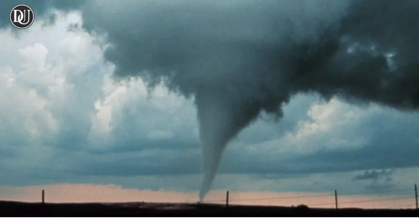
Tornado sirens sounded across the Minneapolis-St. Paul metropolitan area as the storm moved in. Residents quickly took to social media, with storm chasers and locals sharing dramatic footage of funnel clouds approaching populated neighborhoods. Though no tornado touchdowns have been officially confirmed so far, the visual evidence and radar signatures heightened concern.
The tornado watch emphasized that the atmospheric setup — including strong wind shear and unstable air masses — created ideal conditions for severe weather. In addition to tornadoes, the region faces the risk of winds over 70 mph and hailstones exceeding 1.5 inches in diameter. Residents are strongly advised to remain indoors, seek shelter in the lowest level of their homes, and monitor official weather channels for ongoing updates.
The NWS offices in Minneapolis, La Crosse, and Fargo are coordinating closely to deliver timely alerts. Officials also recommend residents have emergency kits ready, including flashlights, bottled water, first-aid supplies, and communication tools like portable radios or mobile apps for weather alerts.
Chicago and surrounding areas are also on high alert, with storms expected to intensify as the system moves eastward. Forecasters believe the threat will persist into the evening, and possibly into Friday morning, depending on the speed and path of the front.
While no casualties or major damage have been reported at this time, authorities urge residents not to be complacent. The situation remains fluid, and new warnings could be issued at any moment. Those in the tornado watch and warning areas should take all necessary precautions to stay safe as the storm continues its course across the Midwest.
The tornado watch remains a critical tool for informing residents of potential severe weather, giving them time to prepare and react. With the tornado watch in place, people should stay vigilant, keep track of weather updates, and follow all safety instructions from local authorities.
The tornado watch issued today serves as a reminder of the unpredictable nature of spring storms in the Midwest. It highlights the importance of community awareness and readiness. As the tornado watch continues, meteorologists will monitor evolving conditions to provide timely warnings and reduce the risk to life and property.
Residents under the tornado watch are advised to have multiple ways to receive alerts, such as NOAA Weather Radios, smartphone apps, and local news broadcasts. The tornado watch is intended to keep people informed of the elevated risk of tornadoes and related severe weather threats.
Emergency responders are also on high alert due to the tornado watch, ready to act quickly if tornadoes or damaging winds develop. The tornado watch helps coordinate these efforts by providing advance notice.
In summary, the tornado watch issued across Minnesota and neighboring states signals a serious weather threat. It urges all residents to stay informed, prepared, and ready to take shelter if conditions worsen. The tornado watch is a vital part of severe weather safety, saving lives by alerting communities ahead of time.